

Drone Roof Survey in Penzance, Cornwall: A Recent Aerisurv Inspection
Accessing a roof safely isn't always straightforward, particularly when the areas requiring closer inspection are difficult to see from ground level.
Aerisurv Ltd was recently commissioned to carry out a drone roof survey in Penzance, Cornwall, providing the client with detailed aerial photographs and video footage of the property without requiring physical access to the roof simply to obtain visual information.
The survey required more than just putting a drone in the air. The property's location meant that appropriate flight planning and coordination were required before the inspection could take place, while conditions on site — including wind and nearby trees — also had to be carefully considered.
What did the client need?
The client wanted clear, detailed imagery of the roof that could be reviewed following the survey.
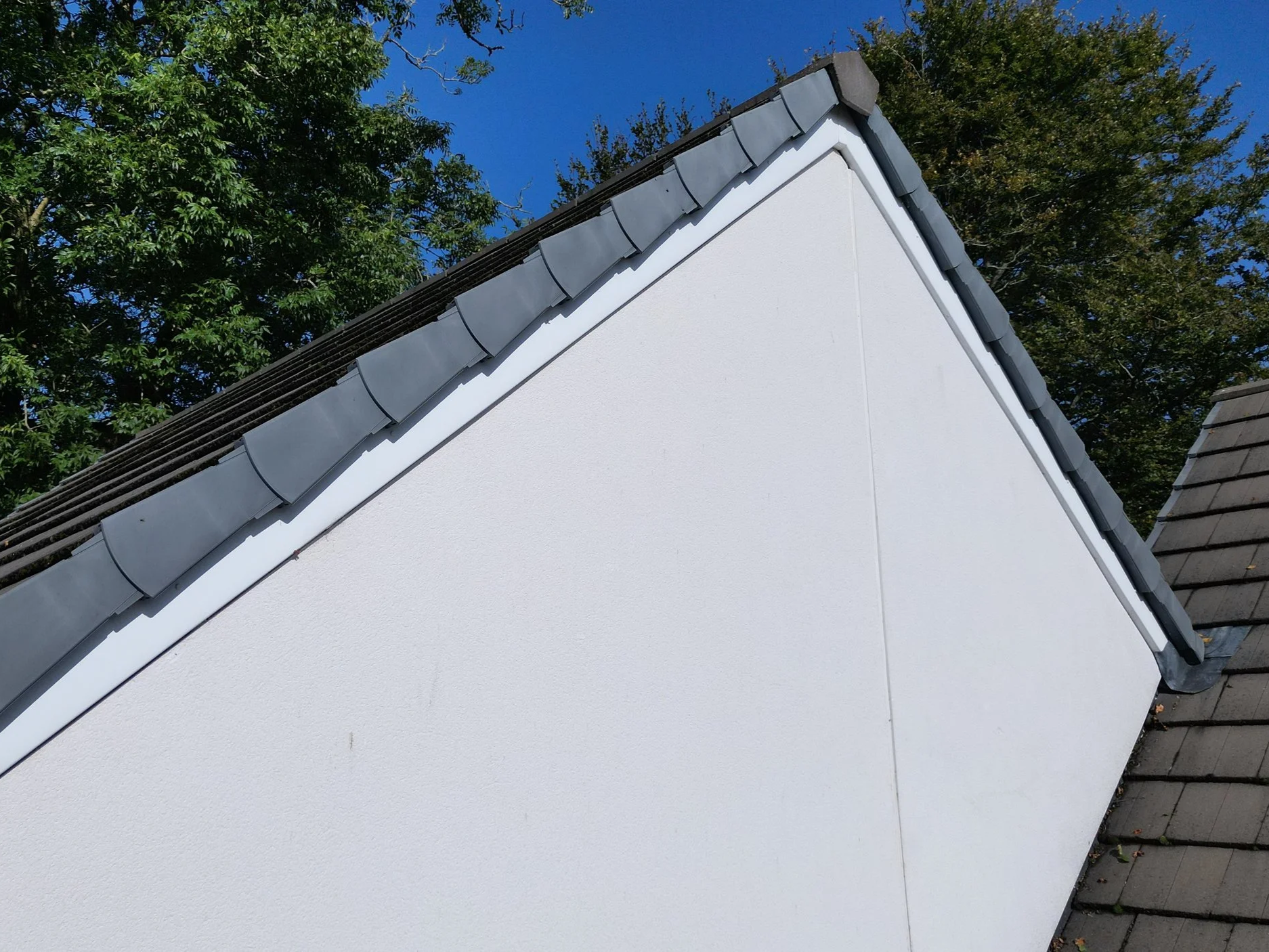
Particular attention was required around specific roof details, including the stepped flashing, alongside more general imagery showing the condition and arrangement of the surrounding roof coverings.
From ground level, obtaining useful views of these areas would have been difficult.
Using a drone allowed us to capture both wider contextual photographs of the roof and closer imagery of the areas the client wanted to examine.
Planning the drone roof inspection
Every drone survey starts before we arrive on site.
For this particular property, its location in Penzance meant that additional flight-planning considerations applied. Aerisurv therefore completed the necessary pre-flight planning and coordination before the survey took place, alongside confirming the appropriate landowner permission.
Weather conditions also needed careful consideration.
Wind and nearby trees presented additional operational factors on the day, so the flight was planned around the conditions to allow the required imagery to be captured safely.
This planning is an important part of a professional drone survey and one of the reasons we ask clients for the property location and survey requirements before confirming an inspection.
What did the drone survey capture?
During the inspection, Aerisurv captured a combination of high-resolution aerial photography and video footage.
The imagery included:
Overall views showing the roof in context
Closer photographs of the roof coverings
Detailed views of specific areas identified by the client
Imagery of the stepped flashing and adjoining roof details
Video footage providing additional visual context
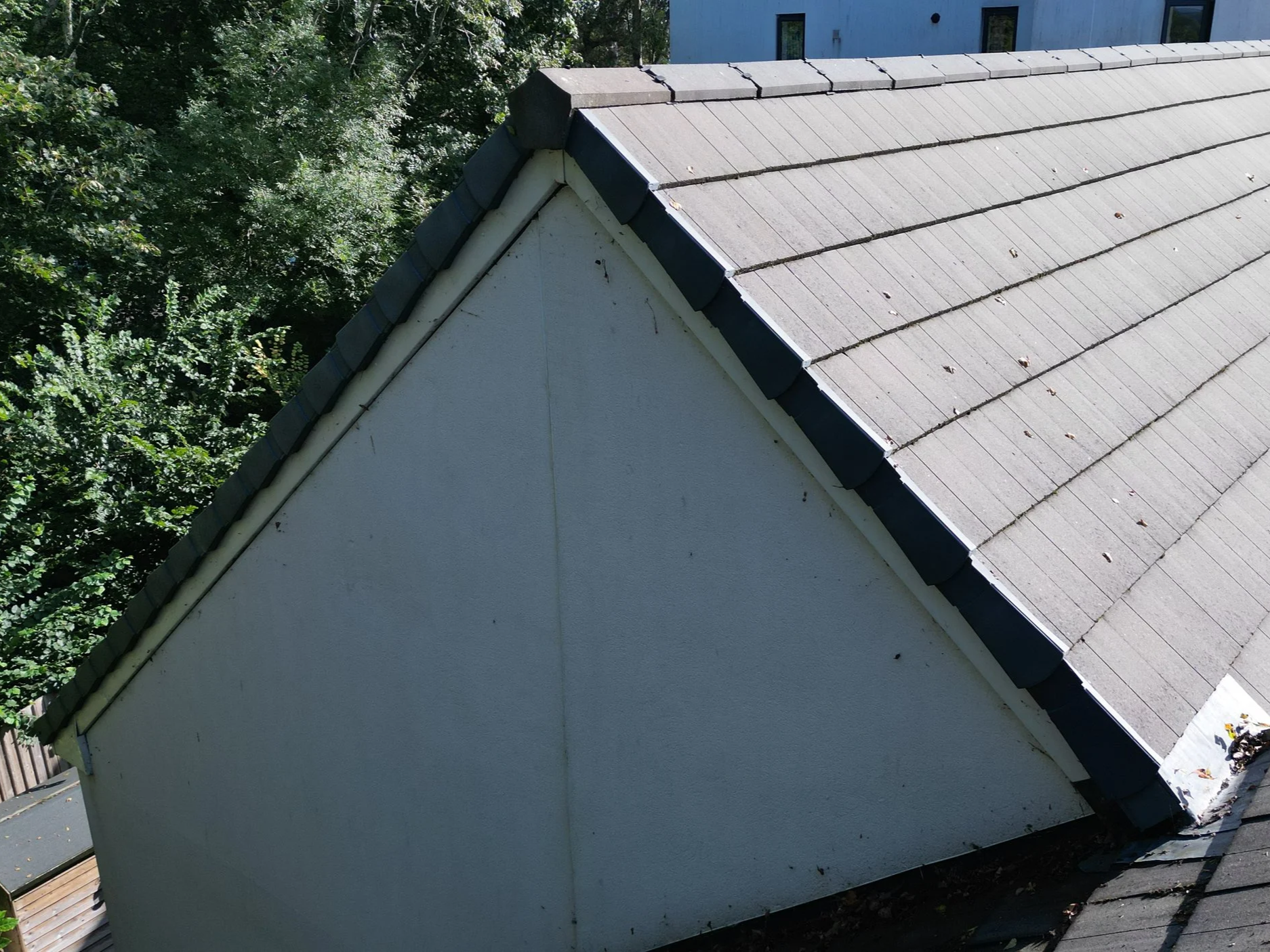
Capturing the roof at different distances and angles gave the client a much more useful visual record than simply supplying a handful of general aerial photographs.
Why use a drone for a roof inspection?
Drone photography can be particularly useful where somebody needs to see and record the condition of difficult-to-access areas of a property.
Roofs, chimneys, flashing, gutters, elevations and other high-level elements can often be photographed from angles that would otherwise be difficult to achieve from ground level.
The resulting photographs and video can then be reviewed on a computer, enlarged where appropriate and shared with other parties involved with the property.
It is important, however, to distinguish between the imagery and the professional assessment of what it shows.
Aerisurv provides high-quality aerial inspection imagery rather than a structural or building survey. Where diagnosis or professional assessment of a defect is required, the imagery can be provided to the client's roofer, surveyor, engineer or other suitably qualified professional.
I think that sentence is worth retaining. It clearly establishes the boundary of what you're selling.
A useful visual record without unnecessary roof access
For this Penzance property, the completed survey provided the client with a detailed collection of aerial photographs and video showing the areas they wanted to examine.
It demonstrates one of the practical applications of drone technology beyond traditional aerial photography: obtaining clear visual information from areas of a property that are difficult to view from the ground.
For property owners, contractors, surveyors and other professionals, that imagery can provide valuable information before deciding whether further investigation or physical access is required.
Need a drone roof survey in Cornwall?
Aerisurv Ltd provides professional drone roof surveys and aerial inspection photography throughout Cornwall and the wider South West, including Penzance and the surrounding area.
We can provide high-resolution aerial photography and video for:
Roofs • Chimneys • Flashing • Gutters • High-level elevations • Commercial properties • Construction sites • Difficult-to-access areas
Each enquiry is considered individually so that we can assess the location, airspace, access requirements and the imagery you actually need before the survey takes place.
Need to discuss an inspection?
Use our Book a Survey page or contact Aerisurv Ltd with the property location and details of the areas you'd like us to photograph.